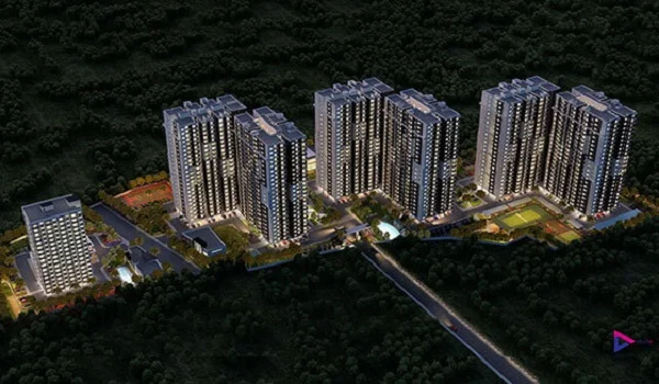
Purva Aerocity Location
Purva Aerocity is located at Vidya Nagar Cross Road, Subs Nagar, Chikkajala, Bangalore 562157. Near Devanahalli in North Bangalore, the area is well-developed. The project is on New Airport Road (NH 44), just a 15-minute drive to Bangalore International Airport.

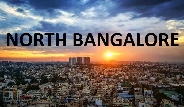
Chikkajala is a village in North Bangalore with growing residential developments. It is close to Devanahalli, the airport is at a distance of 10 km, and Manyata Tech Park is at a distance of 19 km.

Address:
Purva Aerocity
Vidya Nagar Cross Rd,
Subs Nagar, Chikkajala,
Bengaluru, Karnataka - 562 157.
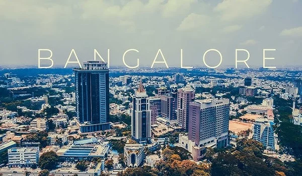
Location is a prime aspect of increasing the market value of real estate properties and development projects. Finding the ideal location with the right property is crucial for investors looking to get significant returns on their capital over time. Chikkajala, which is close to Kempegowda International Airport in North Bangalore, is one such location.
Connectivity

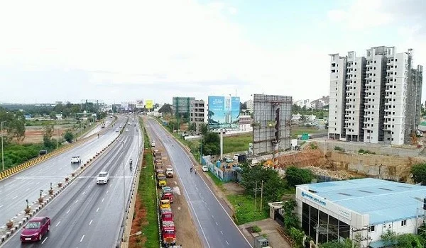
Purva Aerocity, by Puravankara Limited, is in a prominent location, with well-developed roads, an international airport, and other infrastructure enabling quick access to all parts of the city, connecting significant job centres and other regions of the country. The site offers improved accessibility for people with good airport, metro, train, and road access.
As the project is developed in Kempegowda International Main Road in Chikkajala, it has been surrounded by the newly proposed "Elevated Expressway" adjoining the existing connecting NH - 44, which connects the International Airport.
Major Roads connecting from Purva Aerocity :
- NH – 44
- Sadahalli Main Road
- Outer Ring Road
- Expressway (Proposed)
Key Distance from Purva Aerocity to different parts around Bangalore :
- Yelahanka – 10 km
- Devanahalli – 13 km
- Hebbal – 15 km
- Yeshwanthpur – 20 km
Air Connectivity:

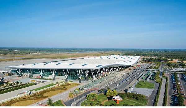
Residents of Purva Aerocity can easily connect to the airport because Kempegowda International Airport is only 12 minutes away and is situated in the same zone as the project. The airport serves as the primary transportation hub for travellers worldwide.
- Kempegowda International Airport – 9 km
Metro Connectivity:

The upcoming Blue Line Metro passes through Chikkajala Metro Station, which is right in front of the project and connects KR Puram and Kempegowda International Airport. Residents of Purva Aerocity can easily access the metro to travel to different parts of the city without any traffic issues.
Near by Metro Stations :
- Chikkajala Metro Station – 1 km
- Doddajala Metro Station – 3 km
Rail Connectivity:

The project's location enables easy access by being close to Bangalore's major Railway Stations. Traffic congestion is reduced when railway services are available for transport nearby. It helps reduce the impact of transportation on the environment by facilitating the boarding of trains for inter-state travel at less crowded railway stops.
Near by Railway Stations :
- Doddajala Railway Station – 4 km
- Bettahalsoor Railway Station – 3 km
Road Connectivity:

Purva Aerocity, built on Chikkajala on a main road connecting to an international airport, has easy access to all parts of the city and different state and national highways. The project area is just in front of a bus terminal. Taking the bus and taxi is more economical and helps protect the environment. Sharing taxis and using public transportation can help cut down on traffic in the city.
- Srinagar – Kanyakumari Highway
- Bellary Main Road
- NH – 44
- Tadipatri – Bangalore Road
- Vidya Nagar Cross Road
Places to visit near Purva Aerocity
Statue of Prosperity (Nadaprabhu Kempegowda Statue) - 8.2 km

The statue of Bangalore's founder is known as the Statue of Prosperity. The Nadaprabhu Kempegowda Statue is in honour of the founder of Bangalore. The statue is situated at Kempegowda International Airport at Devanahalli.
The tallest bronze statue was created in honour of a founder and is listed in the Guinness Book of Records. The statue of the Nadaprabhu Kempegowda, which Indian Prime Minister Sri Narendra Modi inaugurated, is visible while visiting the Airport.
Nandi Hills – 37 km

Nandi Hills is only 37 kilometres from Chikkajala, which is situated in the Chikkaballapur District. The best view for tourists is provided by the thick fog that covers the hills on all four sides during the winter days.
Nandi Hills offer a panoramic view and are connected to the Eastern Ghats. It is also the location of the Nandi temple, Nandi Fort, and the enormous single-rock Nandhi Bull statue.
Trekking trails offer panoramic pictures, and visitors can engage in sports like paragliding and trekking up the hill.
Jakkur Aerodrome – 12 km

Jakkur Aerodrome is in Bangalore's neighbourhood. There is just one runway at Jakkur Aerodrome, which is exclusively used for general aviation. The Airport occupies 214 acres of land, which is used for the training school of the aviation department.
The Karnataka government has run a flying school at the Jakkur airfield since 1949. In addition to enrolled students, during weekends, the general public can also get hands-on experience flying an actual aircraft at 15,000 feet above the earth with the guidance of experienced specialists.
Chikkajala

Chikkajala is set apart in North Bangalore with an exceptional feature in its location. In the surrounding are lakes and open spaces that are preserved well, including Hesaraghatta Lake, Yelahanka Kere, Puttenahalli Lake, Jakkur Lake, Rachenahalli Lake, Hebbal Lake, and Nagawara Lake. Near Hebbal, there is also a theme park called Lumbini Gardens.
Additionally, Chikkajala provides access to important job hubs that are vastly constructed and home to reputable, well-established business centres. Bangalore's expanding IT micro market, which includes Whitefield and Sarjapur Road. Chikkajala is also likely to see substantial expansion as multinational IT/ITES establish campuses in North Bangalore due to its air travel connection, which makes it easier to visit clients in other parts of the country and foreign business travellers.
Chikkajala is rapidly developing as an IT and Manufacturing Hub in various departments. Hence, the Karnataka government has planned to develop an IT cluster on Airport Road, KIABD Aerospace Park, and big-scale Industries are rising on Hoskote Road near the project site, which has spread across the vast land area. Real estate expansion in Chikkajala and Airport Road has improved, providing many housing options.
This growth has increased the property value in Chikkajala and its surrounding areas and improved the lifestyle of the resident's quality of life. Chikkajala, situated on the outskirts of Bangalore, is a thriving and active community that maintains its cultural and traditional roots while providing a pleasant modern lifestyle and growth.
Road Connectivity
Chikkajala is the perfect location for residents and individuals who prioritise travelling to other parts of the city and state to settle down. The SH-104 is a state highway in Karnataka that connects Hebbal, Chikkajala, Bagalur Cross and Devanahalli, connecting Bangalore and Nandhi Hills. The National Highway (NH-44), which links to Bellary Road and Srinagar - Kanyakumari, is only 100 meters from the site. The outer ring road, which links the main different parts of Bangalore city, is only five minutes away.
Roads around Purva Aerocity project :
- Intermediate Town Ring Round
- 8 Lines Bellary - Bangalore Main Road
- Srinagar – Kanyakumari National Highway ( NH – 44)
- Proposed Peripheral Ring Road
Metro Connectivity
The Blue Line metro is currently under construction. It will run from Central Silk Board to Kempegowda International Airport. It is being built in two stages, Phase 2A and 2B. Phase 2A runs from Central Silk Board to KR Puram and has 13 elevated metro stations. Phase 2B runs from KR Puram to Kempegowda International Airport and has 17 elevated metro stations.
Major Metro Stations in Blue Line are:
- Central Silk Board Metro Station
- Bellandur Metro Station
- Marathahalli Metro Station
- KR Puram Metro Station
- Jakkur Plantation Metro
- Hebbal Metro Station
- Kodigehalli Metro Station
- Yelahanka Metro Station
- Bagalur Cross Metro Station
- Chikkajala Metro Station
- Doddajala Metro Station
- KIAL Terminal Metro Station
Going to different city sections will be easier with the upcoming Namma Metro Red & Orange Line connecting to the Blue Line at Hebbal Junction.
Airport Connectivity
Kempegowda International Airport is only 9 km away from Chikkajala, which is easily accessible from there at any time. We can reach the Airport by road by taking the airport road to reach the KIAL terminal without getting in traffic in just 10 to 15 minutes. The BMTC Airport buses will operate throughout the day, facilitating easier connectivity via Chikkajala.
Tech Parks Near Purva Aerocity:

- Manyata Tech Park
- Bagmane Tech Park
- RMZ Infinity
- Embassy Golf Links Business Park
- Brigade Magnum
- L&T Business Park
- Embassy Manyata Business Park
- Kirloskar Business Park
- Karle Town Centre SEZ (Special Economic Zone)
Malls Near Purva Aerocity:

- Esteem Mall, Hebbal
- RMZ Galleria Mall, Yelahanka
- Elements Mall, Thanisandra
- Mantri Square Mall
- Orion Mall
- Elements mall
Schools Near Purva Aerocity:

- Sri Venkateshwara Central School
- Euro kids Pre-School
- Delhi Public School North Bangalore
- National Public School
- Oxford group of Institutes
- Ryan International School
- Deeksha Vidyanagar
- Vedantu Learning Centre
Hospital Near Purva Aerocity:

- N R V Hospital
- The North Bangalore Hospital
- Columbia Asia Hospital
- Cloud Nine Hospital, HRBR
- Cratis Hospital
- MS Ramiah Hospital
- Aster CMI Hospital
Colleges Near Purva Aerocity

- Sai Vidya Institute of Technology
- Oxford School of Nursing
- Academy of Aviation and Engineering
- Sri Revana Siddeshwara Institute of Technology
Frequently Asked Questions
1. Does Purva Aerocity offer easy access to basic amenities?
Purva Aerocity location offers easy connectivity to the best schools, super speciality hospitals, shopping centres, IT parks and many more basic amenities. The residents of Purva Aerocity can easily access these facilities by well-developed roads, flyovers and other well-developed physical infrastructure.
2. Is the project located near the metro station?
The project offers proximity to major metro stations on the International Airport Road, such as Chikkajala metro station and Doddajala metro station.
3. What is the address of Purva Aerocity?
Purva Aerocity's address is Vidya Nagar Cross, Chikkajala, Airport Main Road, Bangalore 562 157.
4. Is Kempegowda International Airport near Purva Aerocity?
Yes, Kempegowda International Airport is Just 10 km from Purva Aerocity, which offers easy connectivity to the residents.
 Whatsapp